Scientists See Insect Outbreaks From Space
A new tool uses satellite imagery to help researchers track small disturbances such as bug infestations, which may increase in scope as climate changes
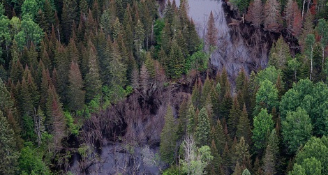
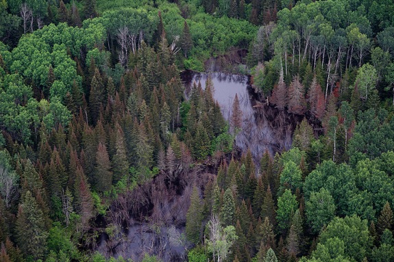
Using new technology, scientists can study how infestations by insects like the western spruce budworm play a role in climate change. Photo by Paul Williams
It’s become a destructive cycle in the western U.S.: Warmer temperatures and drought conditions prolong the life cycle of mountain pine beetles, allowing them to prey on the pine, spruce and fir trees that blanket the mountains. The trees turn reddish-brown before dying off–a phenomenon the National Park Service deemed “an epidemic stretching from Canada to Mexico.” There’s widespread concern that such tree mortality creates an excellent fuel source for wildfires.
Until recently, scientists were left to survey the damage from the ground, with little ability to understand the causes and processes. But now new technology is enabling them to use satellite imagery to identify the sources of small, ecosystem-altering events–some of which, for example beetle outbreaks, are related to climate change drivers. A computer program called LandTrendr, developed by Boston University Earth and Environment professor Robert Kennedy, allows scientists to combine data they collect on the ground with satellite imagery from the U.S. Geological Survey (USGS) and NASA to get a better understanding of environmental disturbances.
Since 1972, NASA and the USGS have deployed satellites that snap specialized digital photographs of Earth’s landscapes. They’re able to capture details that exist in wavelengths invisible to the human eye, including those slightly longer than visible light called the near infrared. Healthy plants reflect energy in the near infrared, and by scanning the imagery, scientists can detect disruptions in Earth’s landscapes.
In the past, these images were prohibitively expensive, limiting scientists’ access. “We’d look at an image from 2000 and one from 2005 and ask, ‘What’s changed?’” Kennedy explained. “If you’re only looking at two images, it’s very difficult to track slowly evolving changes. You can tell something’s changed, but you don’t know how long it’s taken.”
When the USGS began providing these images for free in 2008, it was a turning point for Earth scientists. They now had access to thousands of shots of any given geographic region–images that Kennedy’s LandTrendr tool utilizes. “By looking at all the images, you can watch unfold. You have more confidence that you’re actually seeing trends,” he said. This is particularly useful for understanding climate change and land use change, which are “all about process,” according to Kennedy.
Kennedy is currently using LandTrendr technology to look at the net carbon exchange of forests; among other things, his work analyzes the amount of carbon lost in forests due to fire, clear cuts, partial cuts and urbanization. Studies of climate change in the Arctic and in transition zones between ecosystems are also utilizing LandTrendr. But in the Pacific Northwest, Garrett Meigs, a forestry PhD candidate at Oregon State University, is using LandTrendr to study the intersection of wildfire and insects.
Specifically, Meigs is examining the large wildfires that have ravaged Washington and Oregon since 1985, and how outbreaks of the mountain pine beetle and western spruce budworm affect subsequent fire activity. “When there’s drought, stress, a higher susceptibility to infestation, we can see the dieback of forest,” he said.
The LandTrendr algorithm incorporates satellite images of the regions affected by fire and bugs with Meigs’ own fieldwork and historical aerial data from the U.S. Forest Service, which has long used airplanes to survey insect infestations. “There were things we couldn’t detect or see before, but now we’re able to,” Meigs said.
Below is a video showing a LandTrendr visualization of the Pacific Northwest. Kennedy explains how it works: Stable evergreen forests are represented by the blue areas; when a mountain pine beetle infestation erupts, in this case in the Three Sisters area of Oregon, the imagery glows red. And when a slow-moving western spruce budworm moves into an area–there, the southern foothills of Mount Hood–it morphs yellow.
Could LandTrendr help predict climate change? Possibly. “We can’t see the future, we can only document with the satellites what has happened. But the whole game with science is to develop understandings that allow for prediction,” Kennedy says. “My hope is that by creating these maps and capturing these processes in ways we haven’t been able to see them before, we can test hypotheses” by documenting where, when and if predicted effects occur, he said.
While Meigs’ study of insects and wildfire is largely retrospective, it has the potential to aid in future forecasting efforts. “We have a baseline to measure future change,” he says. “By seeing the conditions leading up to big insect outbreaks or wildfires, we may be able to recognize them as they emerge in the future.”