Will the Next Lake-Effect Snowstorm be Severe? Ask Mountains Far Far Away
Scientists use computer simulations to test how geographic features help create intense snowstorms that blanket cities near lake shores with snow
![]()

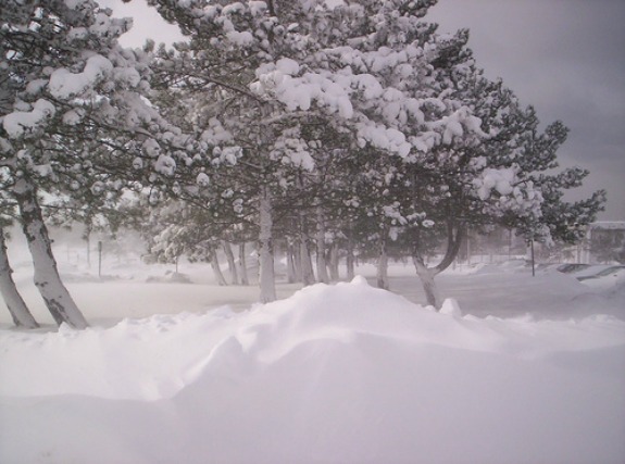
Lake-effect snow, which can blanket communities downwind of lakes, is influenced by upwind geographic features, a new study finds. Photo by Flickr user singloud12
People who live by large, inland bodies of water have a phrase in their lexicon that describes the blizzards that hit them throughout the winter: “lake-effect snow.” When wintry winds blow over wide swaths of warmer lake water, they thirstily suck up water vapor that later freezes and drops as snow downwind, blanketing cities near lake shores. These storms are no joke: a severe one dumped nearly 11 feet of snow over the course of week in Montague, N.Y. before New Year’s Day, 2002; another week-long storm around Veteran’s Day in 1996 dropped around 70 inches of snow and left more than 160,000 residents of Cleveland without power.
Other lake-effect snowstorms, such as those that skim the surface of Utah’s Great Salt Lake, are more of a boon, bringing fresh, deep powder to ski slopes on the leeward side of nearby mountains. But new research shows that mountains don’t just force the moisture-laden winds to dump snow. Mountains upwind can actually help guide the cold air patterns over lakes, helping to produce severely intense snowstorms. Mountains far afield can also deflect cold wind away from water, reducing a lake’s ability to fuel large storms. If these forces work with smaller topographic features, they may help illuminate whether gently rolling hills near the Great Lakes contribute to the creation and intensity of lake-effect snow.
The research, published yesterday in the American Meteorology Society‘s journal, Monthly Weather Review, focused on wind patterns that swirl around the Great Salt Lake. “What we’re showing here is a situation where the terrain is complicated–there are multiple mountain barriers, not just one, and they affect the air flow in a way that influences the development of the lake-effect storm over the lake and lowlands,” said the study’s senior author Jim Steenburgh, in a statement.
Steenburgh, a professor of atmospheric sciences at the University of Utah, and lead author Trevor Alcott, a recent doctoral graduate from the university and now a researcher at the National Weather Service in Salt Lake City, became interested in studying Utah’s winter weather after they noticed that current weather forecast models struggle to anticipate the intensity of the dozen or so lake-effect storms that strike their state’s major cities each winter. These models don’t include the effects of topography, such as the Wasatch Range (which forms the eastern border of the valley that encloses the Great Salt Lake), the Oquirrh Mountains (which forms the western border of the valley) or the mountains along the north and northwest borders of Utah some 150 miles away from the population centers of Salt Lake City and Provo.
So Alcott and Steenburgh ran a computer simulation that incorporated mountains close to the lake as well as those closer to the Idaho and Nevada borders to mimic the creation of a moderate lake effect storm that occurred over the Great Salt Lake from Oct. 26-27, 2010, which brought up to 11 inches of snow to the Wasatch. After their first simulation–their “control”–was complete, they ran several more simulations that plucked out geographic features. Using this method, “We can see what happens if the upstream terrain wasn’t there, if the lake wasn’t there, if the Wasatch Range wasn’t there,” Steenburgh explained.
When they removed the lake and all mountains from their simulation, the model didn’t produce any snowfall. When they kept all the mountains but removed the lake, only 10% of the snow simulated the model of the real storm fell. Keeping the lake but flattening all the mountains resulted in only 6 percent of the snow falling. Resurrecting the Wasatch Range but removing the other mountains yielded 73 percent of the snow compared to the simulation of the real storm.
But the real surprise is what happened when both the Wasatch and Oquirrh ranges were retained, but the ranges in northern Utah at the Idaho and Nevada borders were removed. The result? 61 percent more snowfall than simulated in the real storm. The Wasatch and Oquirrh ranges form a funnel, guiding wind over the lake and enhancing snowfall in the downwind cities of Salt Lake City and Provo. Further, without the barrier of the northern mountains, which range between 7,600 feet to 10,000 feet in peak elevation–considerably less than the Wasatch’s peak elevation of nearly 12,000 feet, waves of cold air can reach the Great Salt Lake without deflection.
In effect, Utah’s major cities are shielded by moderately sized mountains that together cast a long snow shadow!
/https://tf-cmsv2-smithsonianmag-media.s3.amazonaws.com/accounts/headshot/mohi-kumar-240.jpg)
/https://tf-cmsv2-smithsonianmag-media.s3.amazonaws.com/accounts/headshot/mohi-kumar-240.jpg)