Scientists Map Britain’s Most Famous Underwater City
Researchers have created a 3D visualization of Dunwich using acoustic imaging

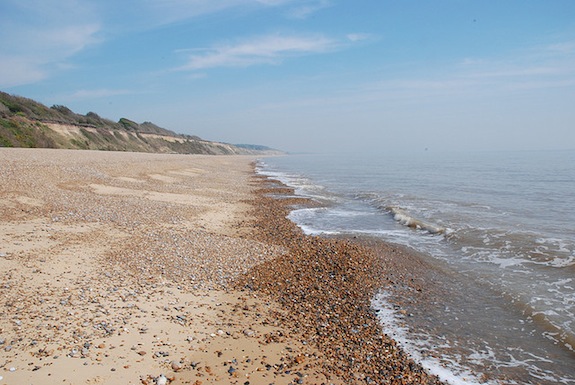
Dunwich beach, across which storms pulled the ancient city. Image: modagoo
In 1066, the town of Dunwich began its march into the sea. After storms swept the farmland out for twenty years, the houses and buildings went in 1328. By 1570, nearly a quarter of the town had been swallowed, and in 1919 the All Saints church disappeared over the cliff. Dunwich is often called Britain’s Atlantis, a medieval town accessible only to divers, sitting quietly at the bottom of the ocean off the British Coast.
Now, researchers have created a 3D visualization of Dunwich using acoustic imaging. David Sear, a professor at the University of Southampton, where the work was done, described the process:
Visibility under the water at Dunwich is very poor due to the muddy water. This has limited the exploration of the site. We have now dived on the site using high resolution DIDSON ™ acoustic imaging to examine the ruins on the seabed – a first use of this technology for non-wreck marine archaeology.
DIDSON technology is rather like shining a torch onto the seabed, only using sound instead of light. The data produced helps us to not only see the ruins, but also understand more about how they interact with the tidal currents and sea bed.
Using this technology gives them a good picture of what the town actually looks like. Ars Technica writes:
We can now see where the local churches stood, and crumbling walls pinpoint the ancient town’s remits. A one kilometer (0.6 mile) square stronghold stood in the center of the 1.8km2space (about 0.7 square miles), with what looks like the remains of Blackfriars Friary, three churches, and the Chapel of St Katherine standing within it. The northern region looks like the commercial hub with lots of smaller buildings largely made of wood. It’s thought that the stronghold, as well as its buildings and a possible town hall, may date back to Saxon times.
Professor Sears sees this project as not just one of historical and archaeological importance, but also as a forecast of the fate of seaside cities. “It is a sobering example of the relentless force of nature on our island coastline. It starkly demonstrates how rapidly the coast can change, even when protected by its inhabitants. Global climate change has made coastal erosion a topical issue in the 21st Century, but Dunwich demonstrates that it has happened before. The severe storms of the 13th and 14th Centuries coincided with a period of climate change, turning the warmer medieval climatic optimum into what we call the Little Ice Age.”
So, in a million years, when aliens come to look at our planet, it might look a lot like Dunwich.
More from Smithsonian.com:
/https://tf-cmsv2-smithsonianmag-media.s3.amazonaws.com/accounts/headshot/Rose-Eveleth-240.jpg)
/https://tf-cmsv2-smithsonianmag-media.s3.amazonaws.com/accounts/headshot/Rose-Eveleth-240.jpg)